

The Soil Temperature Climatology Tool is a product created by the Midwestern Regional Climate Center (MRCC) in collaboration with the USDA Midwest Climate Hub to provide information about the climatology of the dates on which soil temperatures cross various thresholds. The tool provides historical 4” soil temperature statistics based on the period 1991 to 2020 for the North Central United States and can provide information to support on-farm management decisions. This tool can be used to answer various questions including:
- On average, on what day of the year does a location’s soil temperature warm above or cool below a threshold temperature, say 50°F?
- What would be considered an early date for a location’s soil temperature to warm above 50°F What about cool below 50°F?
- What is the record-latest or record-earliest date when a location’s soil temperature has warmed above or cooled below 50°F?
- What is the distribution of dates when a location’s soil temperature has warmed above 50°F?
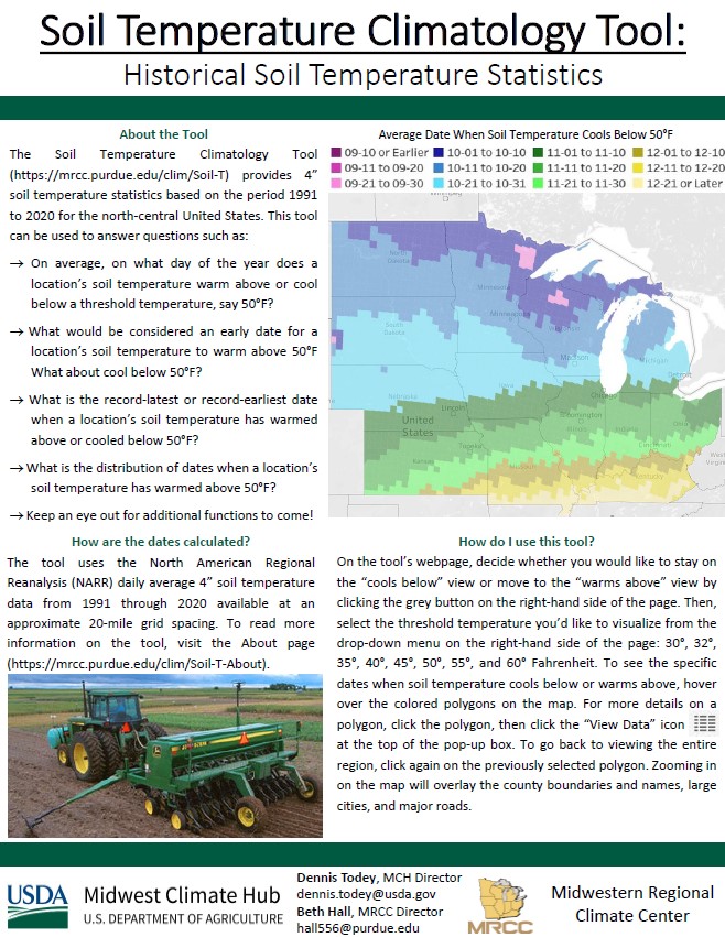
The tool uses the North American Regional Reanalysis (NARR) daily average 4” soil temperature data from 1991 through 2020 available at an approximate 20-mile grid spacing. To read more information on the tool, visit the About page.
Keep an eye out for additional functions to come!
Download our fact sheet about the Soil Temperature Tool
View a recorded webinar about the Soil Temperature Tool